

Seawell Caribbean Islands GPS app for iPhone and iPad
Developer: seawellsoft
First release : 03 Feb 2018
App size: 115.51 Mb
***Seawell marine navigation apps provide maps to make life easier and more enjoyable for sailors, fishermen, divers, boaters and cruisers..
***Ability to Zoom and Pan : Our App has a new feature for intuitive waypoint and route management. You can store and retrieve the real-time markers and favorite waypoints on water. You can zoom and pan effortlessly. Can mark or add favorite spots, dynamically without going back and forth to the chart.
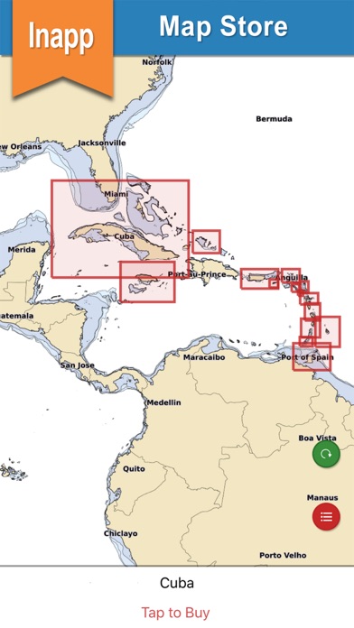
***Purchase of this app includes online maps and a low detailed offline world map. Further, downloading of detailed charts is possible after purchasing through In-App map store provided in the application.
*Anguilla, St Martin & St Barth
*Antigua and Barbuda
*Barbados
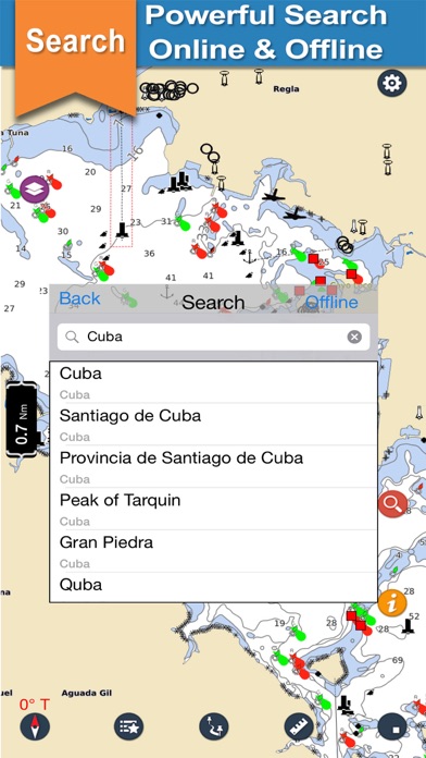
*Cuba
*Dominica and Martinique
*Grenada
*Guadeloupe
*Jamaica
*Montserrat
*Puerto Rico
*Saint Kitts and Saint Nevis
*St.Lucia St.Vincent Grenadines
*Trinidad and Tobago
*Turks and Caicos Islands
*US Virgin Islands
FEATURES:
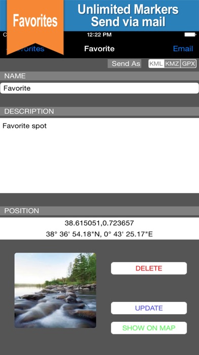
*** Marker : locations can be marked and you can share easily favorite locations with friends and family.
*** KMZ : To send your favorite coordinate through e-mail.
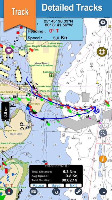
*** Track: Records your path, and stores the details.
*** Measure: Distance can be calculated easily.
*** GPS: Location and heading on map.
*Seawell apps can be used in offline mode.
*Seawell has multiple overlays: Offline, Hybrid, Street mode ,Topo
*Offline: Only offline maps will be displayed which are useful in situations where there is no Internet connectivity. .
*Hybrid: Land areas are covered by satellite imagery.
*Street: Land areas are covered by open street maps.
* Topo : Land areas are covered by topographic maps
*Seawell strives to provide user-friendly apps.
*NOTE : "Continued use of GPS running in the background can decrease battery life”
“Turn off GPS when not in use”